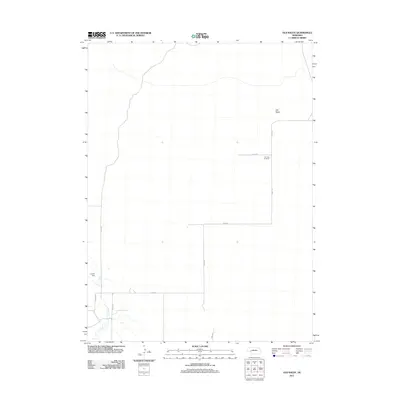
2011 Map of Old Baldy
USGS Topo · Published 2011About this map
Old Baldy rises as a prominent landmark in this sparsely settled portion of Garden County, Nebraska. The landscape is defined by a grid of rural routes, including Road 213 and Road 60, which connect isolated ranching and agricultural sites. Fairview Cemetery stands along Road 55, serving as a primary genealogical touchstone for the area's residents. Water management is critical to this high plains environment, evidenced by Ash Creek and the infrastructure at Lobner Dam. This 2011 survey illustrates the enduring rural character of the Nebraska panhandle, where long-established section lines and names like Road 203 continue to organize the vast open terrain.
Find a feature on this map
11 named features on this map. Tap any name to fly to it.
Don’t see what you’re looking for? This feature index may not catch every label — zoom into the map to look around manually.
Map Details
Editions of this 2011 Old Baldy Map
This is the sole edition of this map. No revisions or reprints were ever made.
Other maps of this area

1897 · Ogallala
USGS Topo · 1:125,000

1900 · Chappell
USGS Topo · 1:125,000

1900 · Ogallala
USGS Topo · 1:125,000

1949 · Rackett
USGS Topo · 1:62,500

1950 · Velma
USGS Topo · 1:62,500

1951 · Rackett
USGS Topo · 1:62,500

1954 · Scottsbluff
USGS Topo · 1:250,000

1954 · North Platte
USGS Topo · 1:250,000

1956 · North Platte
USGS Topo · 1:250,000

1957 · North Platte
USGS Topo · 1:250,000