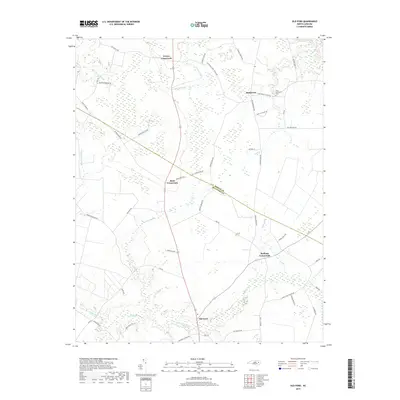
2019 Map of Old Ford
USGS Topo · Published 2019About this map
Old Ford and several dispersed agricultural communities sit at the heart of this coastal plain landscape along the border of Martin and Beaufort counties. The terrain is defined by an intricate network of wetlands and drainage systems, where Bear Grass Swamp and Old Ford Swamp dominate the low-lying reaches. These water bodies, along with Smithwick Creek and Horsepen Swamp, dictate the pattern of rural settlement and road placement. Significant for family historians, the area is punctuated by several longstanding junctions including Batts Crossroads, Stallings Crossroads, and Coreys Crossroads. Near the northern boundary, the Tices Community Cem sits close to Smithwick, serving as a vital landmark for genealogical research in this quiet stretch of Eastern North Carolina.
Find a feature on this map
60 named features on this map. Tap any name to fly to it.
Don’t see what you’re looking for? This feature index may not catch every label — zoom into the map to look around manually.
Map Details
Editions of this 2019 Old Ford Map
This is the sole edition of this map. No revisions or reprints were ever made.
Other maps of this area

1901 · Williamston
USGS Topo · 1:62,500

1902 · Williamston
USGS Topo · 1:62,500

1903 · Chocowinity
USGS Topo · 1:62,500

1905 · Chocowinity
USGS Topo · 1:62,500

1943 · Plymouth
USGS Topo · 1:125,000

1951 · Bunyan
USGS Topo · 1:24,000

1951 · Washington
USGS Topo · 1:24,000

1953 · Rocky Mount
USGS Topo · 1:250,000

1954 · Rocky Mount
USGS Topo · 1:250,000
1978 · Farmlife
USGS Topo · 1:24,000