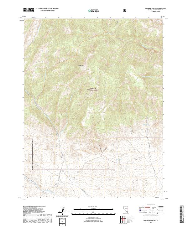
2021 Map of Old Mans Canyon
USGS Topo · Published 2021About this map
The high peaks of the Snake Range dominate this section of the Humboldt National Forest in White Pine County. This landscape is defined by deep incisions through the mountains, notably Old Mans Canyon and Rhodes Canyon, which provide natural conduits through the steep terrain. Water is a critical but scarce resource here, marked by isolated points such as Rhodes Spring and Coyote Spring. The map documents a network of primitive access routes and trails that navigate these corridors, including the Hendrys Creek Trl and the Rock Canyon Trl. To the south, drainage systems like Miller Basin Wash and Spring Cr illustrate the arid hydrology typical of the Great Basin, where seasonal water flow shapes the canyon floors.
Find a feature on this map
30 named features on this map. Tap any name to fly to it.
Don’t see what you’re looking for? This feature index may not catch every label — zoom into the map to look around manually.
Map Details
Editions of this 2021 Old Mans Canyon Map
This is the sole edition of this map. No revisions or reprints were ever made.
Other maps of this area

1956 · Ely
USGS Topo · 1:250,000

1959 · Ely
USGS Topo · 1:250,000

1959 · Sacramento Pass
USGS Topo · 1:62,500

1963 · Ely
USGS Topo · 1:250,000
1986 · Mount Moriah
USGS Topo · 1:24,000
1986 · Baker
USGS Topo · 1:24,000
1986 · The Cove
USGS Topo · 1:24,000
1986 · Little Horse Canyon
USGS Topo · 1:24,000
1986 · Sixmile Canyon
USGS Topo · 1:24,000
1986 · Lehman Caves
USGS Topo · 1:24,000