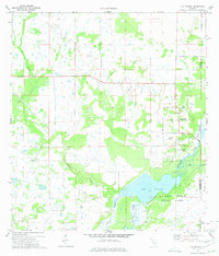
1973 Map of Old Myakka
USGS Topo · Published 1975About this map
Old Myakka and the surrounding ranchlands of eastern Sarasota County appear as a landscape defined by slow-moving drainage and expansive wetlands in the early 1970s. The northern reaches of Myakka River State Park dominate the southeastern quadrant, where Lake Myakka and the Myakka River create a complex aquatic ecosystem. This area is characterized by numerous sloughs, including Gum Slough, Cow Pen Slough, and Vanderipe Slough, which illustrate the natural hydrology of the Florida interior before significant modern development.
Find a feature on this map
27 named features on this map. Tap any name to fly to it.
Don’t see what you’re looking for? This feature index may not catch every label — zoom into the map to look around manually.
Map Details
Editions of this 1973 Old Myakka Map
3 editions found
Other maps of this area

1943 · Laurel
USGS Topo · 1:24,000

1944 · Lower Myakka Lake
USGS Topo · 1:31,680

1944 · Verna
USGS Topo · 1:31,680

1944 · Laurel
USGS Topo · 1:31,680

1944 · Lorraine
USGS Topo · 1:31,680

1944 · Miakka
USGS Topo · 1:31,680

1947 · Bee Ridge
USGS Topo · 1:24,000

1956 · Myakka City
USGS Topo · 1:24,000

1956 · Myakka City NW
USGS Topo · 1:24,000

1956 · Murdock NW
USGS Topo · 1:24,000