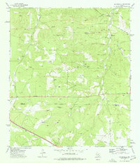
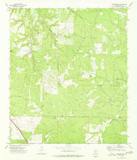
1974 Map of Old Noxville
USGS Topo · Published 1977About this map
Old Noxville serves as the primary landmark on this mid-1970s survey of the Hill Country borderlands. The landscape is defined by the drainage basins of the James River and the Little Devils River, where water sources like The Big Springs and Bur Oak Spring were essential for the area's ranching operations. The prevalence of named windmills, including the Eclipse Windmill, Turkey Windmill, and Back Pasture Windmill, indicates a highly managed pastoral environment where groundwater was carefully tapped across varied terrain like Bell Hollow and Grays Hollow. Genealogists may find interest in the Noxville Cem and the network of local thoroughfares such as Stapp Road and Midway Road that connected these isolated homesteads and ranching outposts across the Kimble Co Kerr Co boundary.
Find a feature on this map
33 named features on this map. Tap any name to fly to it.
Don’t see what you’re looking for? This feature index may not catch every label — zoom into the map to look around manually.
Map Details
Editions of this 1974 Old Noxville Map
This is the sole edition of this map. No revisions or reprints were ever made.
Other maps of this area

1894 · Kerrville
USGS Topo · 1:125,000

1954 · Llano
USGS Topo · 1:250,000

1955 · Llano
USGS Topo · 1:250,000

1956 · Llano
USGS Topo · 1:250,000
1964 · Contrary Creek
USGS Topo · 1:24,000

1964 · Live Oak Ranch
USGS Topo · 1:24,000
1964 · Mountain Home
USGS Topo · 1:24,000
1974 · Noxville
USGS Topo · 1:24,000
1974 · Tobe Branch
USGS Topo · 1:24,000
1974 · Harper West
USGS Topo · 1:24,000