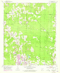
1952 Map of Old Town
USGS Topo · Published 1978About this map
Old Town anchors the southern portion of this landscape at the boundary of Hempstead and Lafayette counties, where the Kansas City Southern railroad cuts through a terrain defined by the complex drainage of Little Bodcau Creek. The settlement pattern in the mid-20th century is deeply tied to historical church and burial sites, including the Old Lewisville Cem and the combined Stricklin Cem Ch near Barnes Pond.
Find a feature on this map
37 named features on this map. Tap any name to fly to it.
Don’t see what you’re looking for? This feature index may not catch every label — zoom into the map to look around manually.
Map Details
Editions of this 1952 Old Town Map
3 editions found
Other maps of this area

1901 · Gurdon
USGS Topo · 1:125,000

1951 · Patmos
USGS Topo · 1:24,000

1951 · Spring Hill
USGS Topo · 1:24,000

1952 · Garland
USGS Topo · 1:24,000

1952 · Old Town
USGS Topo · 1:24,000

1952 · Lewisville
USGS Topo · 1:24,000

1952 · Boyd Hill
USGS Topo · 1:24,000

1953 · El Dorado
USGS Topo · 1:250,000

1957 · El Dorado
USGS Topo · 1:250,000

1958 · El Dorado
USGS Topo · 1:250,000