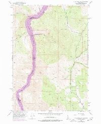
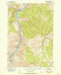
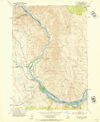
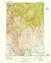
1952 Map of Olds Ferry NW
USGS Topo · Published 1977About this map
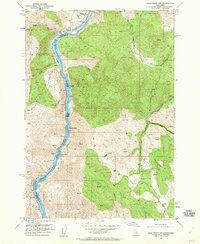
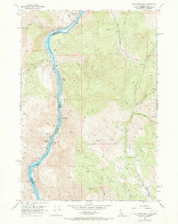
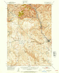
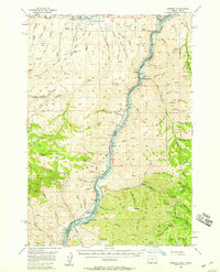
The Snake River Brownlee Reservoir dominates the western boundary of this Idaho-Oregon borderlands area, following the serpentine path between Washington County and Baker County. This map reflects the mid-century landscape as it was updated in the 1970s, showcasing a terrain defined by narrow drainages and high points such as Vabm 4972. The land use appears primarily rural and rugged, characterized by several named watercourses like Morgan Creek, Hibbard Cr, and Horse Creek that flow toward the reservoir. In the southeast, the Henley Basin contains more concentrated water features, including the Henley Reservoir and Henley Basin Creek. A network of Jeep Trails and unclassified roads provides the only infrastructure through the hills, illustrating the isolation of this river-cut territory during the post-war era.
Find a feature on this map
22 named features on this map. Tap any name to fly to it.
Don’t see what you’re looking for? This feature index may not catch every label — zoom into the map to look around manually.
Map Details
Editions of this 1952 Olds Ferry NW Map
4 editions found
Other maps of this area

1915 · Pine
USGS Topo · 1:125,000
1951 · Huntington
USGS Topo · 1:62,500
1952 · Olds Ferry NW
USGS Topo · 1:24,000
1952 · Olds Ferry
USGS Topo · 1:24,000
1952 · Olds Ferry
USGS Topo · 1:62,500

1952 · Olds Ferry SE
USGS Topo · 1:24,000

1955 · Baker
USGS Topo · 1:250,000
1957 · Durkee
USGS Topo · 1:62,500
1957 · Mineral
USGS Topo · 1:62,500

1959 · Baker
USGS Topo · 1:250,000