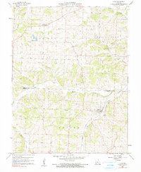
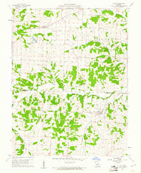
1960 Map of Olean
USGS Topo · Published 1990About this map
Olean serves as the primary hub of this rural Missouri landscape, situated where the Missouri Pacific railroad line intersects with the local road network. The map reveals a community defined by its watercourses and small-scale industry, with South Moreau Creek and Burris Fork cutting through the terrain. Evidence of the area's geological economy is found at the Tiff Mine and a local Quarry, while a Fish Hatchery near the Harrison township line points to a diverse use of the land.
Find a feature on this map
24 named features on this map. Tap any name to fly to it.
Don’t see what you’re looking for? This feature index may not catch every label — zoom into the map to look around manually.
Map Details
Editions of this 1960 Olean Map
2 editions found
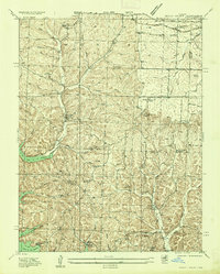
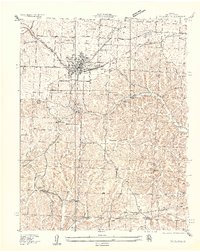
Other maps of this area

1886 · Jefferson City
USGS Topo · 1:125,000

1888 · Versailles
USGS Topo · 1:125,000

1888 · Tuscumbia
USGS Topo · 1:125,000

1888 · Boonville
USGS Topo · 1:125,000

1893 · Versailles
USGS Topo · 1:125,000

1894 · Tuscumbia
USGS Topo · 1:125,000

1894 · Jefferson City
USGS Topo · 1:125,000

1904 · Eldon
USGS Topo · 1:62,500
1935 · Rocky Mount
USGS Topo · 1:24,000
1935 · Eldon
USGS Topo · 1:24,000