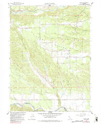
1964 Map of Olinda
USGS Topo · Published 1991About this map
Happy Valley is defined by a landscape of extensive Dredge Tailings, evidence of significant industrial activity between Clear Creek in the north and the Shasta and Tehama County line to the south. The small settlement of Olinda serves as a local hub, featuring the Happy Valley Sch and the Olinda Reservoir. Further west, the community of Cloverdale sits near the Cloverdale Cem, marking an era of rural development and family settlement. The terrain is deeply incised by numerous waterways including China Gulch, Antelope Creek, and Anderson Creek, which flow toward Cottonwood Creek. An Irrigation Canal cuts through the center of the valley, supporting the agricultural life of the region during the mid-1960s. This survey captures the complex drainage patterns and the lingering physical footprint of resource extraction in northern California.
Find a feature on this map
35 named features on this map. Tap any name to fly to it.
Don’t see what you’re looking for? This feature index may not catch every label — zoom into the map to look around manually.
Map Details
Editions of this 1964 Olinda Map
4 editions found
Other maps of this area

1890 · Red Bluff
USGS Topo · 1:250,000

1894 · Red Bluff
USGS Topo · 1:250,000

1901 · Redding
USGS Topo · 1:125,000

1913 · Weaverville
USGS Topo · 1:125,000

1932 · Olinda
USGS Topo · 1:31,680

1935 · Olinda
USGS Topo · 1:31,680

1944 · Redding
USGS Topo · 1:62,500

1944 · French Gulch
USGS Topo · 1:62,500

1946 · Redding
USGS Topo · 1:62,500

1947 · Anderson
USGS Topo · 1:62,500