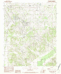
1982 Map of Olive Branch
USGS Topo · Published 1982About this map
The Tennessee Mississippi state line bisects this 1982 provisional survey, where the developing community of Olive Branch serves as the central hub between Shelby and De Soto Counties. The landscape is defined by the northward flow of Camp Creek and the meandering course of the Goldwater River in the south, illustrating the transition from traditional agricultural lands to more modern infrastructure. The Olive Branch Corporate Boundary encircles the town center, while surrounding crossroads settlements like Miller, Fairhaven, and Cedarview maintain their distinct positions within the rural topography.
Find a feature on this map
14 named features on this map. Tap any name to fly to it.
Don’t see what you’re looking for? This feature index may not catch every label — zoom into the map to look around manually.
Map Details
Editions of this 1982 Olive Branch Map
This is the sole edition of this map. No revisions or reprints were ever made.
Other maps of this area

1943 · Collierville
USGS Topo · 1:62,500

1944 · Hernando
USGS Topo · 1:62,500

1948 · Byhalia
USGS Topo · 1:62,500

1953 · Collierville
USGS Topo · 1:50,000

1956 · Blytheville
USGS Topo · 1:250,000

1956 · Tupelo
USGS Topo · 1:250,000

1958 · Tupelo
USGS Topo · 1:250,000

1959 · Blytheville
USGS Topo · 1:250,000

1960 · Bartlett
USGS Topo · 1:62,500

1961 · Bartlett
USGS Topo · 1:62,500