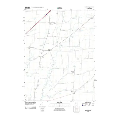
2010 Map of Olive Green
USGS Topo · Published 2010About this map
Big Walnut Creek and its many tributaries, including Little Walnut Creek, Sugar Creek, and Perfect Creek, define the drainage patterns of this central Ohio landscape. The area is characterized by a high density of rural burial sites and historic churchyards, serving as a significant resource for genealogical research. Landmarks such as the Mount Pleasant Methodist Episcopal Churchyard and Porter-Stark Cemetery are scattered among small crossroads communities like Olive Green, Fargo, and Stark Corners. The northern portion of the map features Pagetown and the Chambers Bridge, while the southeastern corner is anchored by Condit and North Condit. Small-scale aviation is represented by Zurik Airport, positioned near the eastern edge. This collection of small settlements and named cemeteries reflects the persistent 19th-century settlement patterns that remain visible even as the region modernizes.
Find a feature on this map
74 named features on this map. Tap any name to fly to it.
Don’t see what you’re looking for? This feature index may not catch every label — zoom into the map to look around manually.
Map Details
Editions of this 2010 Olive Green Map
This is the sole edition of this map. No revisions or reprints were ever made.
Other maps of this area

1902 · Westerville
USGS Topo · 1:62,500

1904 · Westerville
USGS Topo · 1:62,500

1908 · Granville
USGS Topo · 1:62,500

1910 · Granville
USGS Topo · 1:62,500

1915 · Marengo
USGS Topo · 1:62,500

1915 · Fredericktown
USGS Topo · 1:62,500

1943 · Marengo
USGS Topo · 1:62,500

1943 · Fredericktown
USGS Topo · 1:62,500

1950 · Marion
USGS Topo · 1:250,000
1955 · Sunbury
USGS Topo · 1:24,000