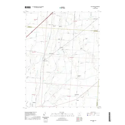
2019 Map of Olive Green
USGS Topo · Published 2019About this map
Big Walnut Creek and its many tributaries, including Culver Cr and Dry Run, define the rolling geography of this central Ohio landscape. The map reveals a dense network of nineteenth-century rural institutions, particularly evident in the concentration of denominational cemeteries and churchyards. Small settlements like Olive Green and East Liberty serve as local anchors, while the crossroads of Stark Corners and Fargo illustrate the historical distribution of small-scale agricultural communities before the expansion of nearby suburban centers. Genealogists will find significant value in the numerous family and community burial grounds documented here, such as Preacher Daveys Graveyard and the Porter-Stark Cem. The layout of the roads, such as Monkey Hollow Rd, follows the irregular drainage patterns of Sugar Cr and Long Run, reflecting a transportation network deeply influenced by the local creek system.
Find a feature on this map
98 named features on this map. Tap any name to fly to it.
Don’t see what you’re looking for? This feature index may not catch every label — zoom into the map to look around manually.
Map Details
Editions of this 2019 Olive Green Map
This is the sole edition of this map. No revisions or reprints were ever made.
Other maps of this area

1902 · Westerville
USGS Topo · 1:62,500

1904 · Westerville
USGS Topo · 1:62,500

1908 · Granville
USGS Topo · 1:62,500

1910 · Granville
USGS Topo · 1:62,500

1915 · Marengo
USGS Topo · 1:62,500

1915 · Fredericktown
USGS Topo · 1:62,500

1943 · Marengo
USGS Topo · 1:62,500

1943 · Fredericktown
USGS Topo · 1:62,500

1950 · Marion
USGS Topo · 1:250,000
1955 · Sunbury
USGS Topo · 1:24,000