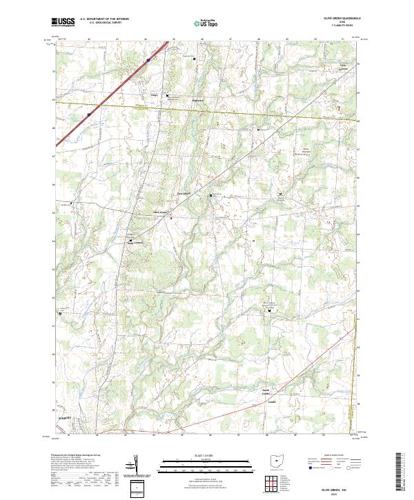
2023 Map of Olive Green
USGS Topo · Published 2023About this map
Olive Green and the surrounding rural townships of Delaware County exhibit a landscape deeply connected to its pioneering roots and nineteenth-century church congregations. The area is defined by the intricate drainage of Big Walnut Creek and its many tributaries, including Little Walnut Creek and Culver Creek. This terrain dictated the placement of early crossroads settlements and the numerous small burial grounds that serve as vital records for genealogists, such as Preacher Davys Graveyard and the Old Blue Cem.
Find a feature on this map
95 named features on this map. Tap any name to fly to it.
Don’t see what you’re looking for? This feature index may not catch every label — zoom into the map to look around manually.
Map Details
Editions of this 2023 Olive Green Map
This is the sole edition of this map. No revisions or reprints were ever made.
Other maps of this area

1902 · Westerville
USGS Topo · 1:62,500

1904 · Westerville
USGS Topo · 1:62,500

1908 · Granville
USGS Topo · 1:62,500

1910 · Granville
USGS Topo · 1:62,500

1915 · Marengo
USGS Topo · 1:62,500

1915 · Fredericktown
USGS Topo · 1:62,500

1943 · Marengo
USGS Topo · 1:62,500

1943 · Fredericktown
USGS Topo · 1:62,500

1950 · Marion
USGS Topo · 1:250,000
1955 · Sunbury
USGS Topo · 1:24,000