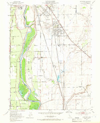
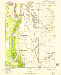
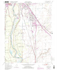
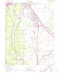
1952 Map of Olivehurst
USGS Topo · Published 1966About this map
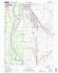
The Feather River defines the landscape of this mid-century survey, its winding course flanked by extensive levee systems protecting the fertile lowlands of the Sacramento Valley. The settlement of Olivehurst appears as a dense grid of streets east of the Western Pacific railroad, while smaller communities like Arboga and Alicia are scattered along the rail corridors. Industrial and recreational development is evident in the presence of the Yuba County Airport and the nearby Midget Auto Race Track.
Find a feature on this map
68 named features on this map. Tap any name to fly to it.
Don’t see what you’re looking for? This feature index may not catch every label — zoom into the map to look around manually.
Map Details
Editions of this 1952 Olivehurst Map
5 editions found
Other maps of this area

1888 · Marysville
USGS Topo · 1:125,000

1888 · Smartsville
USGS Topo · 1:125,000

1891 · Sacramento
USGS Topo · 1:125,000

1891 · Marysville
USGS Topo · 1:125,000

1891 · Smartsville
USGS Topo · 1:125,000

1892 · Sacramento
USGS Topo · 1:125,000

1892 · Smartsville
USGS Topo · 1:125,000

1893 · Sacramento
USGS Topo · 1:125,000

1894 · Smartsville
USGS Topo · 1:125,000

1894 · Marysville
USGS Topo · 1:125,000