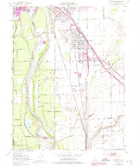
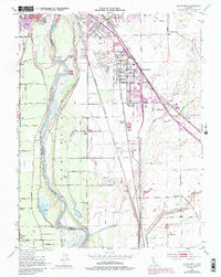
1952 Map of Olivehurst
USGS Topo · Published 1974About this map
The Feather River and Yuba River define this Sacramento Valley landscape, shaping the development of Olivehurst and surrounding agricultural settlements during the mid-20th century. The map documents the extensive network of levees and sloughs, including Gilsizer Slough and Algodon Slough, essential for managing the floodplain of the New Helvetia land grant. Transportation infrastructure is a dominant theme, with the Southern Pacific and Sacramento Northern railroads flanking the growing town of Olivehurst.
Find a feature on this map
61 named features on this map. Tap any name to fly to it.
Don’t see what you’re looking for? This feature index may not catch every label — zoom into the map to look around manually.
Map Details
Editions of this 1952 Olivehurst Map
5 editions found
Other maps of this area

1888 · Marysville
USGS Topo · 1:125,000

1888 · Smartsville
USGS Topo · 1:125,000

1891 · Sacramento
USGS Topo · 1:125,000

1891 · Marysville
USGS Topo · 1:125,000

1891 · Smartsville
USGS Topo · 1:125,000

1892 · Sacramento
USGS Topo · 1:125,000

1892 · Smartsville
USGS Topo · 1:125,000

1893 · Sacramento
USGS Topo · 1:125,000

1894 · Smartsville
USGS Topo · 1:125,000

1894 · Marysville
USGS Topo · 1:125,000