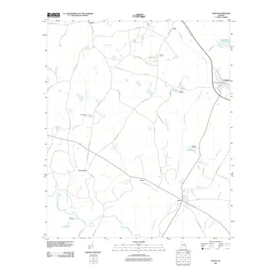
2011 Map of Oliver
USGS Topo · Published 2011About this map
Oliver and Newington anchor this rural Screven County landscape, where the Ogeechee River and its various tributaries define the local geography. The map reveals a community structured by water and agricultural transport, featuring numerous named water bodies such as Meldrim Millpond, Newton Pond, and Durden Pond. Small named settlements like Stalco, Halcyondale, and Captolo are interconnected by a network of secondary roads, including Old Louisville Rd and Sawmill Rd, the latter hinting at the region's timber history. Notable local landmarks like the Newington Post Office and Union Cemetery provide essential points of reference for genealogists. The presence of several dams, such as the Huggins Lake Dam, alongside crossings like Nelson Bridge, underscores how residents have historically managed the many branches and creeks flowing toward the Ogeechee.
Find a feature on this map
52 named features on this map. Tap any name to fly to it.
Don’t see what you’re looking for? This feature index may not catch every label — zoom into the map to look around manually.
Map Details
Editions of this 2011 Oliver Map
This is the sole edition of this map. No revisions or reprints were ever made.
Other maps of this area

1918 · Oliver
USGS Topo · 1:62,500

1919 · Shirley
USGS Topo · 1:62,500

1919 · Egypt
USGS Topo · 1:62,500

1920 · Oliver
USGS Topo · 1:62,500

1921 · Brooklet
USGS Topo · 1:62,500

1939 · Egypt
USGS Topo · 1:62,500

1943 · Brooklet
USGS Topo · 1:62,500

1943 · Egypt
USGS Topo · 1:62,500

1943 · Shirley
USGS Topo · 1:62,500

1943 · Millen
USGS Topo · 1:125,000