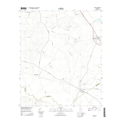
2014 Map of Oliver
USGS Topo · Published 2014About this map
Newington and Oliver anchor this part of Georgia, where the winding path of Ogeechee Cr defines the low-lying landscape near the borders of Screven, Effingham, and Bulloch counties. The map details a network of rural routes and water bodies like Huggins Lake and Meldrin Millpond, illustrating the localized drainage patterns of the region. Distinctive local landmarks, including Nelson Bridge and the Union Cem, sit alongside long-standing transportation corridors such as the Savannah Hwy and Effingham Hwy.
Find a feature on this map
58 named features on this map. Tap any name to fly to it.
Don’t see what you’re looking for? This feature index may not catch every label — zoom into the map to look around manually.
Map Details
Editions of this 2014 Oliver Map
This is the sole edition of this map. No revisions or reprints were ever made.
Other maps of this area

1918 · Oliver
USGS Topo · 1:62,500

1919 · Shirley
USGS Topo · 1:62,500

1919 · Egypt
USGS Topo · 1:62,500

1920 · Oliver
USGS Topo · 1:62,500

1921 · Brooklet
USGS Topo · 1:62,500

1939 · Egypt
USGS Topo · 1:62,500

1943 · Brooklet
USGS Topo · 1:62,500

1943 · Egypt
USGS Topo · 1:62,500

1943 · Shirley
USGS Topo · 1:62,500

1943 · Millen
USGS Topo · 1:125,000