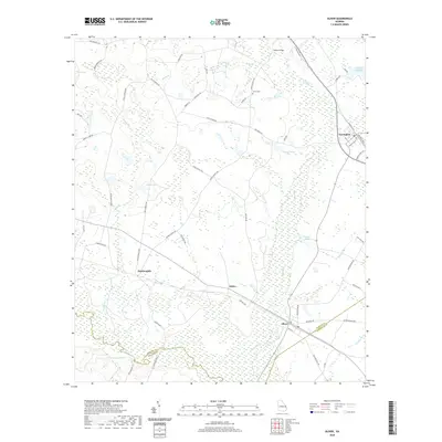
2020 Map of Oliver
USGS Topo · Published 2020About this map
Ogeechee River bottomlands define the southern landscape of this Screven County quadrangle, where the river serves as the natural boundary between Bulloch and Effingham counties. The settlement of Oliver sits just north of the river, connected to the surrounding countryside by a network of rural routes including Saw Mill Rd and Old Louisville Rd. To the northwest, Halcyondale marks a distinct point of historical interest, while the town of Newington occupies the northeastern corner near the Meldrin Millpond. The terrain is characterized by numerous swampy depressions and named water bodies such as Mobley Bay and Huggins Lake. Researchers can locate several rural landmarks that anchor the community's geography, including the Union Cem and routes like Ennis School Rd, which reflect the area's agricultural and educational heritage.
Find a feature on this map
58 named features on this map. Tap any name to fly to it.
Don’t see what you’re looking for? This feature index may not catch every label — zoom into the map to look around manually.
Map Details
Editions of this 2020 Oliver Map
This is the sole edition of this map. No revisions or reprints were ever made.
Other maps of this area

1918 · Oliver
USGS Topo · 1:62,500

1919 · Shirley
USGS Topo · 1:62,500

1919 · Egypt
USGS Topo · 1:62,500

1920 · Oliver
USGS Topo · 1:62,500

1921 · Brooklet
USGS Topo · 1:62,500

1939 · Egypt
USGS Topo · 1:62,500

1943 · Brooklet
USGS Topo · 1:62,500

1943 · Egypt
USGS Topo · 1:62,500

1943 · Shirley
USGS Topo · 1:62,500

1943 · Millen
USGS Topo · 1:125,000