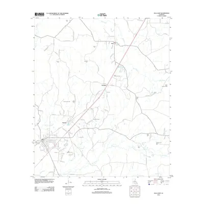
2012 Map of Olla East
USGS Topo · Published 2012About this map
The town of Olla and the smaller settlements of Standard, Spaulding, and Kelly anchor this LaSalle Parish landscape as it appeared in the early 21st century. The local economy is defined by a heavy industrial footprint in energy extraction, with extensive drilling areas including the Spaulding Gas Field, Standard Gas Field, and the North Rabbit Branch Gas Field dotting the terrain. Transportation in the region is characterized by a grid of rural roads such as 3 Cemeteries Road 650 and Micro Tower Rd, while aviation is served by the Olla Airport located south of the main township.
Find a feature on this map
116 named features on this map. Tap any name to fly to it.
Don’t see what you’re looking for? This feature index may not catch every label — zoom into the map to look around manually.
Map Details
Editions of this 2012 Olla East Map
This is the sole edition of this map. No revisions or reprints were ever made.
Other maps of this area

1940 · Columbia
USGS Topo · 1:62,500

1953 · Alexandria
USGS Topo · 1:250,000

1954 · Sikes
USGS Topo · 1:62,500

1954 · Tullos
USGS Topo · 1:62,500

1955 · Shreveport
USGS Topo · 1:250,000

1955 · Alexandria
USGS Topo · 1:250,000

1955 · Olla
USGS Topo · 1:62,500

1956 · Shreveport
USGS Topo · 1:250,000

1957 · Columbia
USGS Topo · 1:62,500

1984 · Shreveport
USGS Topo · 1:250,000