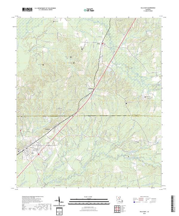
2024 Map of Olla East
USGS Topo · Published 2024About this map
Caldwell Parish and Lasalle Parish meet in this forested central Louisiana corridor, where the small settlements of Olla, Standard, and Spaulding line the primary transit route. The landscape is defined by its numerous small drainages, including Castor Creek and Chickasaw Creek, which cut through the undulating terrain. A high concentration of family and community burial grounds, such as Saint Joseph Cem and Good Hope Cem, suggests a long-established rural population and provides significant data for genealogical research. The northern section near Kelly is marked by older paths like Three Cemeteries Road 650 and School House RD 641, pointing to the historic layout of community centers before modern road alignments. This survey captures the rural character of the region, where timber and small-scale agriculture are shaped by the winding paths of Black Bayou and Bear Branch.
Find a feature on this map
104 named features on this map. Tap any name to fly to it.
Don’t see what you’re looking for? This feature index may not catch every label — zoom into the map to look around manually.
Map Details
Editions of this 2024 Olla East Map
This is the sole edition of this map. No revisions or reprints were ever made.
Other maps of this area

1940 · Columbia
USGS Topo · 1:62,500

1953 · Alexandria
USGS Topo · 1:250,000

1954 · Sikes
USGS Topo · 1:62,500

1954 · Tullos
USGS Topo · 1:62,500

1955 · Shreveport
USGS Topo · 1:250,000

1955 · Alexandria
USGS Topo · 1:250,000

1955 · Olla
USGS Topo · 1:62,500

1956 · Shreveport
USGS Topo · 1:250,000

1957 · Columbia
USGS Topo · 1:62,500

1984 · Shreveport
USGS Topo · 1:250,000