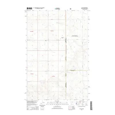
2014 Map of Ollie
USGS Topo · Published 2014About this map
Ollie sits at the intersection of local history and the high plains landscape where eastern Montana meets the North Dakota border. This cattle-country terrain is defined by the drainage of Beaver Cr and its tributaries, including the Fork of Beaver Cr and Bull Run Cr. The map captures a transition from the structured township grids of Fallon County into the protected expanse of the Little Missouri National Grassland to the east. Topographically, the area is characterized by the distinctive Hat Creek Breaks, which introduce complex relief into the otherwise steady descent toward the river basins. Historical transit routes such as the Mondak Trl and Ollie Rd highlight the enduring importance of these trail corridors for ranching and regional connectivity in a sparsely populated territory.
Find a feature on this map
27 named features on this map. Tap any name to fly to it.
Don’t see what you’re looking for? This feature index may not catch every label — zoom into the map to look around manually.
Map Details
Editions of this 2014 Ollie Map
This is the sole edition of this map. No revisions or reprints were ever made.
Other maps of this area
1953 · Miles City
USGS Topo · 1:250,000
1953 · Dickinson
USGS Topo · 1:250,000
1957 · Dickinson
USGS Topo · 1:250,000
1957 · Miles City
USGS Topo · 1:250,000
1958 · Miles City
USGS Topo · 1:250,000
1980 · Golva
USGS Topo · 1:24,000
1980 · Pretty Butte
USGS Topo · 1:24,000
1980 · Belfield
USGS Topo · 1:100,000
1981 · Baker
USGS Topo · 1:100,000
1981 · Morris Butte
USGS Topo · 1:24,000