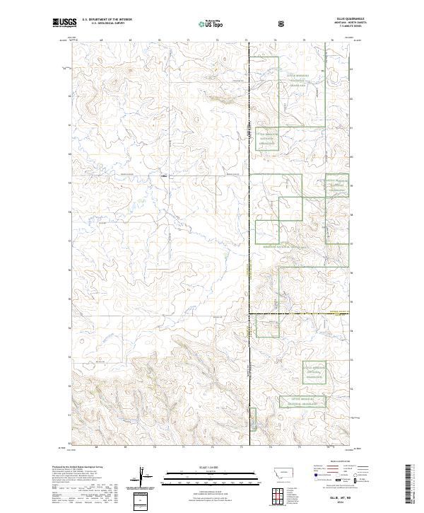
2024 Map of Ollie
USGS Topo · Published 2024About this map
The community of Ollie serves as the focal point of this high-plains landscape, situated along the north-south axis of Tatley Rd and Ollie Rd. The map documents a complex border region where Fallon County, Montana, meets the North Dakota state line, intersecting with both Golden Valley and Slope counties. This geography is defined by its drainage systems, with Beaver Creek and Mud Creek carving through the terrain alongside family-named routes such as Beaver Slide Rd. To the east, the sprawling protected lands of the Little Missouri National Grassland provide a contrast to the section-line road network of the Montana side. Researchers can trace the path of the Mon Dak Trl as it follows the state boundary, reflecting the historical connectivity between these two prairie states. The varied topography is further detailed through watercourses like Horse Creek and Bull Run Creek, illustrating the natural irrigation and landmarks essential to this ranching and grassland region.
Find a feature on this map
34 named features on this map. Tap any name to fly to it.
Don’t see what you’re looking for? This feature index may not catch every label — zoom into the map to look around manually.
Map Details
Editions of this 2024 Ollie Map
This is the sole edition of this map. No revisions or reprints were ever made.
Other maps of this area

1953 · Miles City
USGS Topo · 1:250,000

1953 · Dickinson
USGS Topo · 1:250,000

1957 · Dickinson
USGS Topo · 1:250,000

1957 · Miles City
USGS Topo · 1:250,000

1958 · Miles City
USGS Topo · 1:250,000

1980 · Golva
USGS Topo · 1:24,000

1980 · Pretty Butte
USGS Topo · 1:24,000

1980 · Belfield
USGS Topo · 1:100,000

1981 · Baker
USGS Topo · 1:100,000
1981 · Morris Butte
USGS Topo · 1:24,000