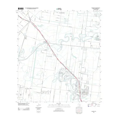
2013 Map of Olmito
USGS Topo · Published 2013About this map
Olmito and Rancho Viejo define this South Texas landscape, where the ancient delta distributaries of the Rio Grande create a distinctive pattern of winding resacas and modern water management. The map details a complex network of reservoirs and canals, including the Resaca de los Cuates Reservoir and the Main Supply Canal, which support the agricultural and residential growth of Cameron County. Smaller settlements such as Villa Cavazos, Russelltown, and Green Valley Farms are clustered along the major transportation corridors of Expressway 77 and Expressway 83. Of particular interest to local historians are the named ranches and historic land features like Wardner Ranch and the uniquely named Tahuachal Banco Number 9, illustrating the region's deep ties to ranching and the shifting course of the nearby river.
Find a feature on this map
159 named features on this map. Tap any name to fly to it.
Don’t see what you’re looking for? This feature index may not catch every label — zoom into the map to look around manually.
Map Details
Editions of this 2013 Olmito Map
This is the sole edition of this map. No revisions or reprints were ever made.
Other maps of this area

1929 · Rio Hondo
USGS Topo · 1:24,000

1929 · Harlingen
USGS Topo · 1:24,000

1929 · La Paloma
USGS Topo · 1:24,000

1930 · Los Fresnos
USGS Topo · 1:24,000

1930 · West Brownsville
USGS Topo · 1:24,000

1930 · Barreda
USGS Topo · 1:24,000

1930 · Laguna Atascosa
USGS Topo · 1:24,000

1930 · East Brownsville
USGS Topo · 1:24,000

1932 · Rio Hondo
USGS Topo · 1:31,680

1932 · Harlingen
USGS Topo · 1:31,680