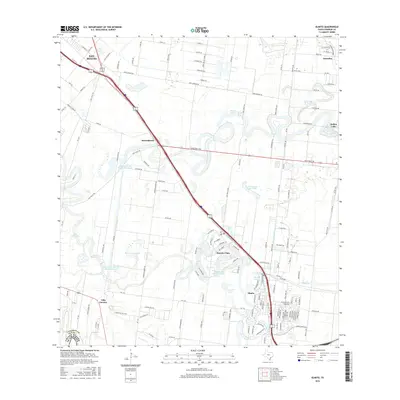
2016 Map of Olmito
USGS Topo · Published 2016About this map
Rancho Viejo and the surrounding Lower Rio Grande Valley landscape appear in this detailed topographic survey, defined by the winding oxbow lakes known locally as resacas. These distinctive water bodies, including Resaca del Rancho Viejo and Resaca del Jardin, represent the ancestral remnants of the river's changing course, now serving as focal points for settlements like Olmito and Russelltown. The map illustrates a transition from the dense urban edge of San Benito in the northwest to the agricultural tracts and residential subdivisions scattered along the resaca banks.
Find a feature on this map
149 named features on this map. Tap any name to fly to it.
Don’t see what you’re looking for? This feature index may not catch every label — zoom into the map to look around manually.
Map Details
Editions of this 2016 Olmito Map
This is the sole edition of this map. No revisions or reprints were ever made.
Other maps of this area

1929 · Rio Hondo
USGS Topo · 1:24,000

1929 · Harlingen
USGS Topo · 1:24,000

1929 · La Paloma
USGS Topo · 1:24,000

1930 · Los Fresnos
USGS Topo · 1:24,000

1930 · West Brownsville
USGS Topo · 1:24,000

1930 · Barreda
USGS Topo · 1:24,000

1930 · Laguna Atascosa
USGS Topo · 1:24,000

1930 · East Brownsville
USGS Topo · 1:24,000

1932 · Rio Hondo
USGS Topo · 1:31,680

1932 · Harlingen
USGS Topo · 1:31,680