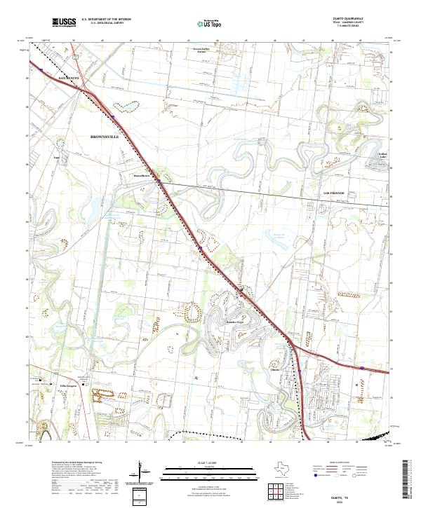
2022 Map of Olmito
USGS Topo · Published 2022About this map
Rancho Viejo and Olmito anchor a landscape defined by the winding resacas of the Rio Grande delta, where former river channels now serve as vital reservoirs and community focal points. This modern 2022 survey illustrates the transition from the dense urban edge of Brownsville and San Benito to the irrigated agricultural tracts and suburban developments of the Lower Rio Grande Valley. The complex water management system is evident through features like the Main Supply Canal and Olmito Br, which feed into numerous water bodies including Resaca de Los Cuates Reservoir and Olmito Lake.
Find a feature on this map
168 named features on this map. Tap any name to fly to it.
Don’t see what you’re looking for? This feature index may not catch every label — zoom into the map to look around manually.
Map Details
Editions of this 2022 Olmito Map
This is the sole edition of this map. No revisions or reprints were ever made.
Other maps of this area

1929 · Rio Hondo
USGS Topo · 1:24,000

1929 · Harlingen
USGS Topo · 1:24,000

1929 · La Paloma
USGS Topo · 1:24,000

1930 · Los Fresnos
USGS Topo · 1:24,000

1930 · West Brownsville
USGS Topo · 1:24,000

1930 · Barreda
USGS Topo · 1:24,000

1930 · Laguna Atascosa
USGS Topo · 1:24,000

1930 · East Brownsville
USGS Topo · 1:24,000

1932 · Rio Hondo
USGS Topo · 1:31,680

1932 · Harlingen
USGS Topo · 1:31,680