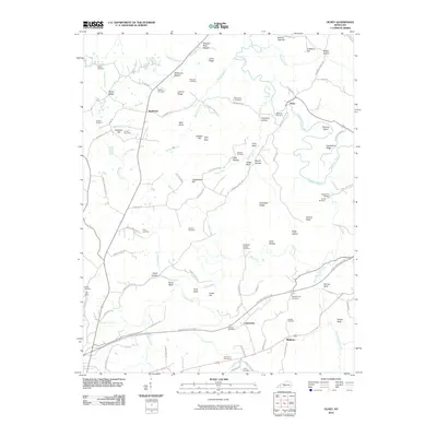
2010 Map of Olney
USGS Topo · Published 2010About this map
The Tradewater River winds through this landscape north of the modern Western Kentucky Pkwy, creating a network of ridges and hollows such as Stillhouse Hollow and Hurricane Hollow. Small communities like Olney and Needmore anchor the northern reaches, while Midway and Lewistown sit further south, reflecting the historical distribution of rural settlements in Kentucky.
Find a feature on this map
106 named features on this map. Tap any name to fly to it.
Don’t see what you’re looking for? This feature index may not catch every label — zoom into the map to look around manually.
Map Details
Editions of this 2010 Olney Map
This is the sole edition of this map. No revisions or reprints were ever made.
Other maps of this area

1907 · Earlington
USGS Topo · 1:48,000

1908 · Princeton
USGS Topo · 1:62,500

1909 · Dawson Springs
USGS Topo · 1:48,000

1909 · Earlington
USGS Topo · 1:62,500

1909 · Providence
USGS Topo · 1:62,500

1910 · Princeton
USGS Topo · 1:62,500

1911 · Dawson Springs
USGS Topo · 1:62,500

1953 · Dawson Springs SW
USGS Topo · 1:24,000

1954 · Evansville
USGS Topo · 1:250,000
1954 · Shady Grove
USGS Topo · 1:24,000