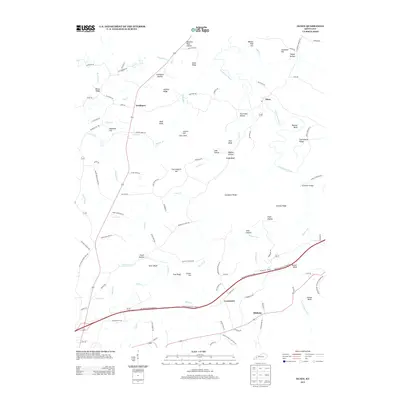
2013 Map of Olney
USGS Topo · Published 2013About this map
Tradewater River winds through the eastern portion of this landscape, forming the backdrop for the small settlements of Olney and Needmore. The terrain is defined by a dense network of bluffs and hollows, including Paddy Bluff, Barnes Bluff, and Stillhouse Hollow, indicating a history of timber and perhaps smaller-scale agricultural operations. To the south, the Western Kentucky Parkway cuts a modern path near Lewistown and Midway, contrasting with the winding local roads that trace the older ridges. Family and local history are etched into the names of landmarks like Creekmur Bridge and Cottonpatch Hill. The prevalence of named hollows such as Buzzard Rock Hollow and Happy Hollow suggests a rugged topography where early development was concentrated along the creeks, including Flynn Fork and Elk Cr.
Find a feature on this map
113 named features on this map. Tap any name to fly to it.
Don’t see what you’re looking for? This feature index may not catch every label — zoom into the map to look around manually.
Map Details
Editions of this 2013 Olney Map
This is the sole edition of this map. No revisions or reprints were ever made.
Other maps of this area

1907 · Earlington
USGS Topo · 1:48,000

1908 · Princeton
USGS Topo · 1:62,500

1909 · Dawson Springs
USGS Topo · 1:48,000

1909 · Earlington
USGS Topo · 1:62,500

1909 · Providence
USGS Topo · 1:62,500

1910 · Princeton
USGS Topo · 1:62,500

1911 · Dawson Springs
USGS Topo · 1:62,500

1953 · Dawson Springs SW
USGS Topo · 1:24,000

1954 · Evansville
USGS Topo · 1:250,000
1954 · Shady Grove
USGS Topo · 1:24,000