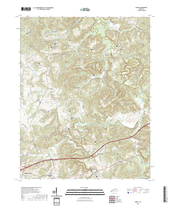
2022 Map of Olney
USGS Topo · Published 2022About this map
The Tradewater River carves a winding path along the boundary of Caldwell and Hopkins counties, anchoring a landscape of deep hollows and family-named ridges. This interior section of Western Kentucky is characterized by its numerous rural burial grounds and country sanctuaries, such as the Liberty Cumberland Presbyterian Church Cem and Sugar Creek Baptist Church Cem, which serve as vital landmarks for local genealogy.
Find a feature on this map
139 named features on this map. Tap any name to fly to it.
Don’t see what you’re looking for? This feature index may not catch every label — zoom into the map to look around manually.
Map Details
Editions of this 2022 Olney Map
This is the sole edition of this map. No revisions or reprints were ever made.
Other maps of this area

1907 · Earlington
USGS Topo · 1:48,000

1908 · Princeton
USGS Topo · 1:62,500

1909 · Dawson Springs
USGS Topo · 1:48,000

1909 · Earlington
USGS Topo · 1:62,500

1909 · Providence
USGS Topo · 1:62,500

1910 · Princeton
USGS Topo · 1:62,500

1911 · Dawson Springs
USGS Topo · 1:62,500

1953 · Dawson Springs SW
USGS Topo · 1:24,000

1954 · Evansville
USGS Topo · 1:250,000
1954 · Shady Grove
USGS Topo · 1:24,000