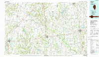
1986 Map of Olney
USGS Topo · Published 1988About this map
The Little Wabash River and Skillet Fork drain this productive agricultural region of Southern Illinois, where the landscape is defined by a grid of rural section lines and a network of historic settlements. In this mid-1980s landscape, the Baltimore & Ohio RR remains a primary corridor for commerce, linking communities like Flora, Clay City, and Noble to the regional hub at Olney. Farther north, the Illinois Central Gulf RR serves the western edge through Farina and Edgewood.
Find a feature on this map
78 named features on this map. Tap any name to fly to it.
Don’t see what you’re looking for? This feature index may not catch every label — zoom into the map to look around manually.
Map Details
Editions of this 1986 Olney Map
2 editions found
Other maps of this area

1903 · Patoka
USGS Topo · 1:125,000

1904 · Mount Carmel
USGS Topo · 1:62,500

1910 · Hardinville
USGS Topo · 1:62,500

1911 · Sumner
USGS Topo · 1:62,500

1913 · Sumner
USGS Topo · 1:62,500

1914 · Centralia
USGS Topo · 1:62,500

1933 · Mount Vernon
USGS Topo · 1:48,000

1934 · Salem
USGS Topo · 1:62,500

1935 · Centralia
USGS Topo · 1:62,500

1938 · Salem
USGS Topo · 1:62,500