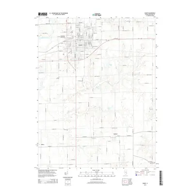
2015 Map of Olney
USGS Topo · Published 2015About this map
Olney serves as the primary hub of this Richland County landscape, centered on the campus of Illinois Eastern Community Colleges-Olney Central College. The settlement pattern is defined by a dense grid of streets such as W Main St and E Il-250, transitioning into a rural network of cemeteries and water bodies. Numerous burial grounds are mapped across the quadrangle, including Haven Hill Cem and Saint Joseph Cem near the town center, and the more remote Fritschle Cem to the northeast.
Find a feature on this map
73 named features on this map. Tap any name to fly to it.
Don’t see what you’re looking for? This feature index may not catch every label — zoom into the map to look around manually.
Map Details
Editions of this 2015 Olney Map
This is the sole edition of this map. No revisions or reprints were ever made.
Other maps of this area

1910 · Hardinville
USGS Topo · 1:62,500

1911 · Sumner
USGS Topo · 1:62,500

1913 · Sumner
USGS Topo · 1:62,500

1941 · Newton
USGS Topo · 1:62,500

1943 · Newton
USGS Topo · 1:62,500

1949 · Olney
USGS Topo · 1:62,500

1956 · Vincennes
USGS Topo · 1:250,000

1957 · Vincennes
USGS Topo · 1:250,000

1958 · Vincennes
USGS Topo · 1:250,000

1958 · Belleville
USGS Topo · 1:250,000