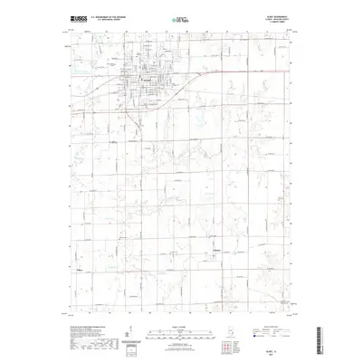
2021 Map of Olney
USGS Topo · Published 2021About this map
Olney serves as the primary hub of this Richland County landscape, centered on a dense grid of streets and residential blocks. The town's institutional character is anchored by Olney Central College on the north side, while its history is preserved in numerous burial grounds like Haven Hill Cem, Saint Josephs Cem, and Maple Dale Cem. To the south, the settlement of Calhoun and the small locality of Elbow mark the rural transition where agricultural land is dissected by an intricate drainage network. Significant water features including the Fox River, Little Fox Cr, and Turkey Cr define the topography, with Illinois No-Name-Number 2037 Reservoir providing a substantial body of water to the west. This modern survey reflects the enduring pattern of Midwestern section-line roads and dispersed rural landmarks like Liberty Lawn Cem and Richland Cem.
Find a feature on this map
86 named features on this map. Tap any name to fly to it.
Don’t see what you’re looking for? This feature index may not catch every label — zoom into the map to look around manually.
Map Details
Editions of this 2021 Olney Map
This is the sole edition of this map. No revisions or reprints were ever made.
Other maps of this area

1910 · Hardinville
USGS Topo · 1:62,500

1911 · Sumner
USGS Topo · 1:62,500

1913 · Sumner
USGS Topo · 1:62,500

1941 · Newton
USGS Topo · 1:62,500

1943 · Newton
USGS Topo · 1:62,500

1949 · Olney
USGS Topo · 1:62,500

1956 · Vincennes
USGS Topo · 1:250,000

1957 · Vincennes
USGS Topo · 1:250,000

1958 · Vincennes
USGS Topo · 1:250,000

1958 · Belleville
USGS Topo · 1:250,000