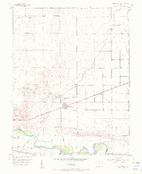
1954 Map of Olney Springs
USGS Topo · Published 1956About this map
The Arkansas River serves as the focal point for this mid-century irrigation and transport corridor along the boundary of Crowley and Otero Counties. The landscape is defined by an intricate network of water management features, including the Colorado Canal on Levee, Otero Canal on Levee, and numerous laterals like the Auckland Lateral and Bradbury Lightburn Lateral. These systems support the agricultural environment surrounding Olney Springs, where the Olney Springs Water Supply and the Olney Springs Res. indicate the essential role of water storage in this semi-arid region.
Find a feature on this map
32 named features on this map. Tap any name to fly to it.
Don’t see what you’re looking for? This feature index may not catch every label — zoom into the map to look around manually.
Map Details
Editions of this 1954 Olney Springs Map
2 editions found
Other maps of this area

1891 · Catlin
USGS Topo · 1:125,000

1891 · Nepesta
USGS Topo · 1:125,000

1893 · Nepesta
USGS Topo · 1:125,000

1893 · Catlin
USGS Topo · 1:125,000

1904 · Nepesta
USGS Topo · 1:125,000

1954 · Olney Springs
USGS Topo · 1:24,000

1954 · Elder
USGS Topo · 1:24,000

1954 · Ordway
USGS Topo · 1:24,000

1954 · Manzanola
USGS Topo · 1:24,000

1954 · Lamar
USGS Topo · 1:250,000