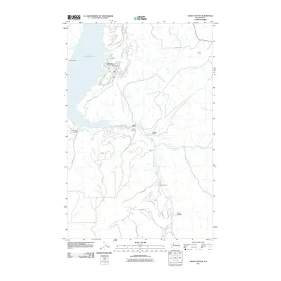
2011 Map of Olsen Canyon
USGS Topo · Published 2011About this map
Seven Bays serves as a prominent recreational and residential focal point on the eastern shore of Franklin D Roosevelt Lake in Lincoln County. This 2011 survey documents the established street grid of the community, including Airport Rd and Granite Dr N, centered around the 7-Bays Airport. The geography is defined by the deep incisions of the Columbia River plateau, where numerous drainage systems such as Olsen Canyon, Moonshine Canyon, and Bean Canyon converge toward the reservoir.
Find a feature on this map
39 named features on this map. Tap any name to fly to it.
Don’t see what you’re looking for? This feature index may not catch every label — zoom into the map to look around manually.
Map Details
Editions of this 2011 Olsen Canyon Map
This is the sole edition of this map. No revisions or reprints were ever made.
Other maps of this area

1948 · Lincoln
USGS Topo · 1:62,500

1948 · Turtle Lake
USGS Topo · 1:62,500

1950 · Lincoln
USGS Topo · 1:62,500

1950 · Turtle Lake
USGS Topo · 1:62,500

1953 · Ritzville
USGS Topo · 1:250,000

1959 · Ritzville
USGS Topo · 1:250,000

1965 · Ritzville
USGS Topo · 1:250,000

1969 · Telford
USGS Topo · 1:24,000

1969 · Rocklyn
USGS Topo · 1:24,000
1969 · Davenport
USGS Topo · 1:24,000