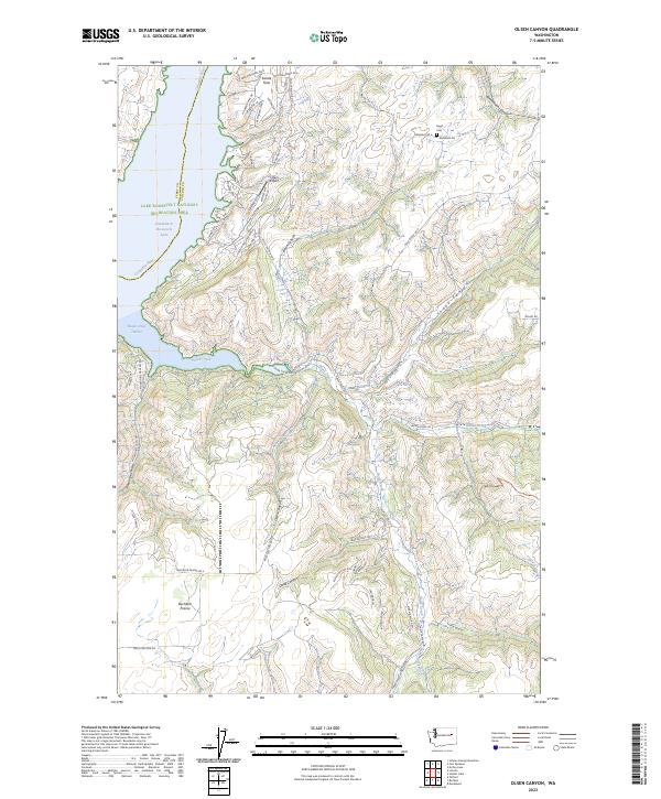
2023 Map of Olsen Canyon
USGS Topo · Published 2023About this map
Lake Roosevelt National Recreation Area dominates the western edge of this landscape, where the Columbia River and Franklin D Roosevelt Lake meet the steep, carved drainages of eastern Washington. The terrain is defined by a series of significant canyons including Olsen Canyon, Bockemuehl Canyon, and Trinkle Canyon, which channel seasonal water toward the reservoir. Local history is anchored at Egypt Cem in the northeast, while the settlement pattern shows a distinct shift from the upland reaches of Swede Flats and Bachelor Prairie toward the modern recreational development near 7 Bays Airport. Boaters and outdoor enthusiasts utilize the access points at Hawk Creek Harbor and the Hawk Creek Campground Road, where the landscape transitions from high plateau farming to the water's edge at Hawk Creek Falls.
Find a feature on this map
67 named features on this map. Tap any name to fly to it.
Don’t see what you’re looking for? This feature index may not catch every label — zoom into the map to look around manually.
Map Details
Editions of this 2023 Olsen Canyon Map
This is the sole edition of this map. No revisions or reprints were ever made.
Other maps of this area

1948 · Lincoln
USGS Topo · 1:62,500

1948 · Turtle Lake
USGS Topo · 1:62,500

1950 · Lincoln
USGS Topo · 1:62,500

1950 · Turtle Lake
USGS Topo · 1:62,500

1953 · Ritzville
USGS Topo · 1:250,000

1959 · Ritzville
USGS Topo · 1:250,000

1965 · Ritzville
USGS Topo · 1:250,000

1969 · Telford
USGS Topo · 1:24,000

1969 · Rocklyn
USGS Topo · 1:24,000
1969 · Davenport
USGS Topo · 1:24,000