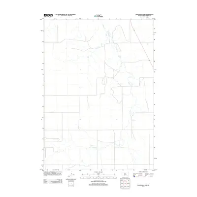
2012 Map of Olsonville NW
USGS Topo · Published 2012About this map
Antelope Cr meanders through this section of the Rosebud Reservation in South Dakota, defining the drainage patterns of the rural landscape in the early 21st century. The map depicts a territory primarily structured by a simple grid of section lines and gravel roads, reflecting the open, managed lands of Todd County. Notable transit corridors such as Lakeview Rd and the Crookston and Lakeview Rd intersect the southern portion of the quadrangle, indicating the primary routes for local travel and agricultural transport. The sparse distribution of named features emphasize the predominantly open nature of the terrain, where watercourses like the creek remain the most prominent natural landmarks for orienting oneself in this part of the northern plains.
Find a feature on this map
3 named features on this map. Tap any name to fly to it.
Don’t see what you’re looking for? This feature index may not catch every label — zoom into the map to look around manually.
Map Details
Editions of this 2012 Olsonville NW Map
This is the sole edition of this map. No revisions or reprints were ever made.
Other maps of this area

1955 · Martin
USGS Topo · 1:250,000

1958 · Martin
USGS Topo · 1:250,000

1969 · Mission
USGS Topo · 1:24,000

1969 · Soldier Creek SE
USGS Topo · 1:24,000

1969 · Olsonville NW
USGS Topo · 1:24,000

1969 · Rosebud
USGS Topo · 1:24,000

1969 · Olsonville SW
USGS Topo · 1:24,000

1969 · St. Francis SE
USGS Topo · 1:24,000

1982 · Olsonville
USGS Topo · 1:24,000

1982 · Olsonville SE
USGS Topo · 1:24,000