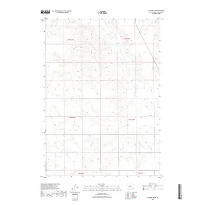
2017 Map of Olsonville NW
USGS Topo · Published 2017About this map
Antelope Cr meanders through the heart of this Todd County landscape, carving a dendritic drainage pattern across the high plains of the Rosebud reservation. The map reveals a land defined by its section lines and remote rural corridors, where the intersection of Crookston & Lakeview Rd and Lakeview Rd anchors the southwestern corner. This 2017 survey illustrates the sparse, open character of the terrain just north of the Nebraska border, highlighting a network of gravel roads including 288th St and 292nd St that serve isolated ranching outposts. The detailed contour intervals emphasize the subtle ridges and draws that define this portion of the northern Great Plains, providing a clear record of the physical geography and road infrastructure in this part of South Dakota.
Find a feature on this map
12 named features on this map. Tap any name to fly to it.
Don’t see what you’re looking for? This feature index may not catch every label — zoom into the map to look around manually.
Map Details
Editions of this 2017 Olsonville NW Map
This is the sole edition of this map. No revisions or reprints were ever made.
Other maps of this area

1955 · Martin
USGS Topo · 1:250,000

1958 · Martin
USGS Topo · 1:250,000

1969 · Mission
USGS Topo · 1:24,000

1969 · Soldier Creek SE
USGS Topo · 1:24,000

1969 · Olsonville NW
USGS Topo · 1:24,000

1969 · Rosebud
USGS Topo · 1:24,000

1969 · Olsonville SW
USGS Topo · 1:24,000

1969 · St. Francis SE
USGS Topo · 1:24,000

1982 · Olsonville
USGS Topo · 1:24,000

1982 · Olsonville SE
USGS Topo · 1:24,000