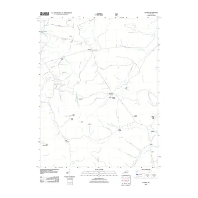
2010 Map of Olympia
USGS Topo · Published 2010About this map
Olympia Springs and the surrounding hills of Bath County reveal a landscape shaped by mineral springs and early industrial ventures. The northern portion of the map highlights the area's iron-working history through the Slate Blockhouse Furnace and the nearby Blockhouse Iron Mine, while Howard Hill Mine further indicates the region's historic extractive activity. Family history is well-preserved across the quadrangle, with Jackson Cemetery, Shrout Cemetery, and Old Fields Cemetery marking the hillsides above Washers Branch and Rose Run.
Find a feature on this map
81 named features on this map. Tap any name to fly to it.
Don’t see what you’re looking for? This feature index may not catch every label — zoom into the map to look around manually.
Map Details
Editions of this 2010 Olympia Map
This is the sole edition of this map. No revisions or reprints were ever made.
Other maps of this area

1892 · Beattyville
USGS Topo · 1:125,000

1929 · Salt Lick
USGS Topo · 1:62,500

1934 · Salt Lick
USGS Topo · 1:62,500

1952 · Preston
USGS Topo · 1:24,000

1952 · Owingsville
USGS Topo · 1:24,000

1952 · Scranton
USGS Topo · 1:24,000

1952 · Frenchburg
USGS Topo · 1:24,000

1952 · Means
USGS Topo · 1:24,000

1953 · Olympia
USGS Topo · 1:24,000

1953 · Farmers
USGS Topo · 1:24,000