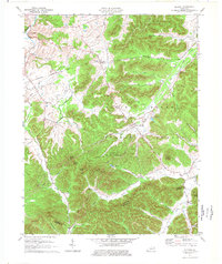
1977 Map of Olympia
USGS Topo · Published 1977About this map
Bourbon Furnace (Ruins) stands near Mill Creek at the northwest corner of this quadrangle, a remnant of the region's early industrial heritage. The landscape is characterized by the dense woodlands of the Daniel Boone National Forest and Olympia State Forest, where prominent peaks like Mount Olympus and Big Mountain rise above the drainage basins of Mud Lick Creek and East Fork Slate Creek. The settlement of Olympia serves as a local hub, situated along the Chesapeake and Ohio railroad line which snakes through the valleys to navigate the ridgelines. Local history and genealogy researchers will find several small burial grounds, including Shrout Cem and Old Fields Cem, alongside rural landmarks like Blevins Valley Ch. The terrain transitions from the broader Blevins Valley to narrow hollows like Pigeon Roost Hollow and Richard Hollow, illustrating the traditional Appalachian settlement patterns defined by available creek bottomlands.
Find a feature on this map
54 named features on this map. Tap any name to fly to it.
Don’t see what you’re looking for? This feature index may not catch every label — zoom into the map to look around manually.
Map Details
Editions of this 1977 Olympia Map
This is the sole edition of this map. No revisions or reprints were ever made.
Other maps of this area

1892 · Beattyville
USGS Topo · 1:125,000

1929 · Salt Lick
USGS Topo · 1:62,500

1934 · Salt Lick
USGS Topo · 1:62,500

1952 · Preston
USGS Topo · 1:24,000

1952 · Owingsville
USGS Topo · 1:24,000

1952 · Scranton
USGS Topo · 1:24,000

1952 · Frenchburg
USGS Topo · 1:24,000

1952 · Means
USGS Topo · 1:24,000

1953 · Olympia
USGS Topo · 1:24,000

1953 · Farmers
USGS Topo · 1:24,000