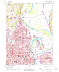
1956 Map of Omaha North
USGS Topo · Published 1977About this map
The Missouri River carves a complex boundary between Nebraska and Iowa in this mid-century survey, defining the industrial and residential growth of Omaha and Council Bluffs. The landscape is dominated by the massive curve of Carter Lake, an oxbow that isolates the community of Carter Lake within Nebraska despite its Iowa jurisdiction. Near the riverbanks, significant transportation infrastructure like Eppley Airfield and the Mormon Bridge (Toll) facilitate interstate movement, while the Chicago and North Western and Union Pacific railroads service the urban core.
Find a feature on this map
77 named features on this map. Tap any name to fly to it.
Don’t see what you’re looking for? This feature index may not catch every label — zoom into the map to look around manually.
Map Details
Editions of this 1956 Omaha North Map
5 editions found
Other maps of this area

1893 · Omaha
USGS Topo · 1:62,500

1893 · Fremont
USGS Topo · 1:125,000

1896 · Fremont
USGS Topo · 1:125,000

1954 · Omaha
USGS Topo · 1:250,000

1955 · Fremont
USGS Topo · 1:250,000

1956 · Ralston
USGS Topo · 1:24,000

1956 · Irvington
USGS Topo · 1:24,000

1956 · Council Bluffs North
USGS Topo · 1:24,000

1956 · Omaha North
USGS Topo · 1:24,000

1956 · Council Bluffs South
USGS Topo · 1:24,000