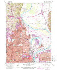
1956 Map of Omaha North
USGS Topo · Published 1989About this map
Omaha and its surrounding riverfront communities are captured here during a period of significant mid-century expansion. The urban landscape of the Nebraska side is anchored by prominent institutions such as Creighton University, Duchesne College, and the U of Nebraska College of Medicine, reflecting the city's role as a regional center for education and healthcare. The historic Fort Omaha stands as a landmark of military heritage, while the extensive grounds of Forest Lawn Cemetery and Holy Sepulchre Cemetery suggest the long-established residential character of the western hills.
Find a feature on this map
86 named features on this map. Tap any name to fly to it.
Don’t see what you’re looking for? This feature index may not catch every label — zoom into the map to look around manually.
Map Details
Editions of this 1956 Omaha North Map
5 editions found
Other maps of this area

1893 · Omaha
USGS Topo · 1:62,500

1893 · Fremont
USGS Topo · 1:125,000

1896 · Fremont
USGS Topo · 1:125,000

1954 · Omaha
USGS Topo · 1:250,000

1955 · Fremont
USGS Topo · 1:250,000

1956 · Ralston
USGS Topo · 1:24,000

1956 · Irvington
USGS Topo · 1:24,000

1956 · Council Bluffs North
USGS Topo · 1:24,000

1956 · Omaha North
USGS Topo · 1:24,000

1956 · Council Bluffs South
USGS Topo · 1:24,000