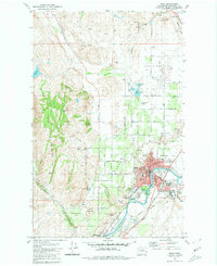
1980 Map of Omak
USGS Topo · Published 1980About this map
The Okanogan River corridor defines the landscape between Omak and Okanogan, where the river valley supports a concentrated hub of civic and industrial activity. This late-century survey documents the transition from the irrigated orchards of Bide a Wee Flat to the foothills of Pogue Mountain. The map details the local infrastructure of the era, from the Wenatchee Valley College campus and North Sch to the Mid Valley Hospital and the nearby Fish Hatchery. Cultural markers are prominent, including Okanogan Memorial Gardens and the Omak Memorial Cemetery. Transport and industry are represented by the Burlington Northern line and several extraction sites like the Brook Mine and various Gravel Pits, illustrating the active extraction and distribution economy of Okanogan County.
Find a feature on this map
61 named features on this map. Tap any name to fly to it.
Don’t see what you’re looking for? This feature index may not catch every label — zoom into the map to look around manually.
Map Details
Editions of this 1980 Omak Map
2 editions found
Other maps of this area

1902 · Osoyoos
USGS Topo · 1:125,000

1904 · Osoyoos
USGS Topo · 1:125,000

1905 · Okanogan
USGS Topo · 1:125,000

1906 · Chopaka
USGS Topo · 1:125,000

1953 · Omak Lake
USGS Topo · 1:62,500

1954 · Okanogan
USGS Topo · 1:250,000

1957 · Okanogan
USGS Topo · 1:62,500

1957 · Conconully
USGS Topo · 1:62,500

1957 · Tonasket
USGS Topo · 1:62,500

1958 · Okanogan
USGS Topo · 1:250,000