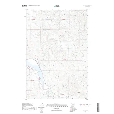
2020 Map of Oman Ranch
USGS Topo · Published 2020About this map
Willapa Bay defines the western edge of this coastal Pacific County landscape, where tidal waters meet a dense network of river drainages. The geography is dominated by the three branches of the Nemah—the North Nemah River, Middle Nemah River, and South Nemah River—which cut through the timbered terrain toward the bay. The eponymous Oman Ranch sits near the shoreline just south of Roaring Cr Slough, representing the long-standing agricultural and ranching presence in this corner of Washington. Inland, the topography rises toward Longfellow Hill, with numerous smaller waterways like Holm Cr and Petes Cr threading through the valleys. Local names are preserved in the landscape through features like Wirkkala Ponds and the network of rural routes including Parpala Rd and Dionne Ln.
Find a feature on this map
32 named features on this map. Tap any name to fly to it.
Don’t see what you’re looking for? This feature index may not catch every label — zoom into the map to look around manually.
Map Details
Editions of this 2020 Oman Ranch Map
This is the sole edition of this map. No revisions or reprints were ever made.
Other maps of this area

1938 · Fort Columbia
USGS Topo · 1:62,500

1938 · South Bend
USGS Topo · 1:62,500

1940 · Brookfield
USGS Topo · 1:62,500

1940 · South Bend
USGS Topo · 1:62,500

1943 · Fort Columbia
USGS Topo · 1:62,500

1949 · Chinook
USGS Topo · 1:24,000

1949 · Upper Naselle River
USGS Topo · 1:24,000

1949 · Oman Ranch
USGS Topo · 1:24,000

1949 · Knappton
USGS Topo · 1:24,000

1949 · Rosburg
USGS Topo · 1:24,000