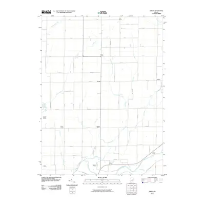
2010 Map of Omega
USGS Topo · Published 2010About this map
Omega and Walnut Grove anchor this portion of northern Hamilton County, illustrating a landscape defined by a grid of rural roads and a complex network of waterways. The southern boundary is traced by the White River, which receives the waters of Duck Creek and Dyers Creek. The terrain is deeply inscribed with small family and community burial grounds, providing a significant resource for genealogical research. Locations such as Hobbs Cemetery, Buscher Cemetery, and the Emmanuel Lutheran Cemetery are preserved amidst the agricultural plots. The map reveals the hydrology of the Till Plain, where numerous small runs and branches, including Sugar Run, Weasel Creek, and the West Fork Bear Creek, cut through the section lines. This 2010 survey shows the persistence of small unincorporated settlements like Aroma in an area that remains largely defined by its original pioneer-era drainage and cemetery locations.
Find a feature on this map
60 named features on this map. Tap any name to fly to it.
Don’t see what you’re looking for? This feature index may not catch every label — zoom into the map to look around manually.
Map Details
Editions of this 2010 Omega Map
This is the sole edition of this map. No revisions or reprints were ever made.
Other maps of this area

1953 · Lapel
USGS Topo · 1:24,000

1953 · Riverwood
USGS Topo · 1:24,000

1953 · Noblesville
USGS Topo · 1:24,000

1953 · Danville
USGS Topo · 1:250,000

1953 · Muncie
USGS Topo · 1:250,000

1955 · Danville
USGS Topo · 1:250,000

1956 · Muncie
USGS Topo · 1:250,000

1956 · Danville
USGS Topo · 1:250,000

1960 · Noblesville
USGS Topo · 1:24,000

1960 · Elwood
USGS Topo · 1:24,000