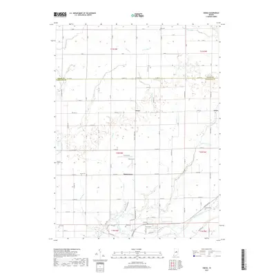
2019 Map of Omega
USGS Topo · Published 2019About this map
The farming hamlets of Omega, Walnut Grove, and Aroma define this stretch of the Indiana heartland along the border of Hamilton and Tipton counties. The landscape is heavily structured by its water management, featuring a dense network of drainage channels such as Sloan Ditch, Rogers Ditch, and Lamberson Ditch that feed into Cicero Creek and Duck Creek. These engineering efforts transformed the central Indiana plains into some of the most productive agricultural land in the state. In the southern portion of the map, the White River winds through the terrain, accompanied by the Katewiwi Park Northern Trail Loop. Local aviation history is also evident with small landing strips like Cruzan Field, Ward Airport, and Irion Airport serving the rural community. Numerous family and community burial grounds, including Buscher Cem and Grubbs Cem, provide important touchstones for genealogical research in this long-settled region.
Find a feature on this map
58 named features on this map. Tap any name to fly to it.
Don’t see what you’re looking for? This feature index may not catch every label — zoom into the map to look around manually.
Map Details
Editions of this 2019 Omega Map
This is the sole edition of this map. No revisions or reprints were ever made.
Other maps of this area

1953 · Lapel
USGS Topo · 1:24,000

1953 · Riverwood
USGS Topo · 1:24,000

1953 · Noblesville
USGS Topo · 1:24,000

1953 · Danville
USGS Topo · 1:250,000

1953 · Muncie
USGS Topo · 1:250,000

1955 · Danville
USGS Topo · 1:250,000

1956 · Muncie
USGS Topo · 1:250,000

1956 · Danville
USGS Topo · 1:250,000

1960 · Noblesville
USGS Topo · 1:24,000

1960 · Elwood
USGS Topo · 1:24,000