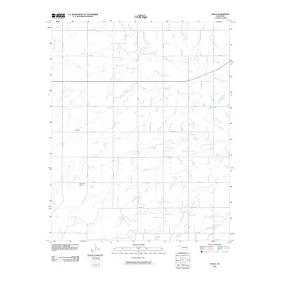
2009 Map of Omega
USGS Topo · Published 2009About this map
Kingfisher Creek and Otter Creek carve winding paths through this section of the Oklahoma plains near Altona, defining a landscape primarily organized by the rigid grid of the Public Land Survey System. The map reveals a rural environment where land use is etched into the earth by a network of section-line roads, including e0830 RD and n2700 RD. Cheyenne Butte stands as a notable topographic landmark in the southwestern quadrant, rising above the surrounding agricultural fields. For those tracing local heritage, Zion Cemetery serves as a significant site of historical continuity, situated among the farmsteads and drainage patterns that have shaped Kingfisher County for generations.
Find a feature on this map
21 named features on this map. Tap any name to fly to it.
Don’t see what you’re looking for? This feature index may not catch every label — zoom into the map to look around manually.
Map Details
Editions of this 2009 Omega Map
This is the sole edition of this map. No revisions or reprints were ever made.
Other maps of this area

1893 · Fort Reno
USGS Topo · 1:62,500

1893 · Loyal
USGS Topo · 1:62,500

1941 · Fort Reno
USGS Topo · 1:62,500

1942 · Fort Reno
USGS Topo · 1:62,500

1942 · Geary
USGS Topo · 1:62,500

1949 · Fort Reno
USGS Topo · 1:62,500

1955 · Clinton
USGS Topo · 1:250,000

1957 · Clinton
USGS Topo · 1:250,000
1972 · Loyal SE
USGS Topo · 1:24,000
1972 · Omega
USGS Topo · 1:24,000