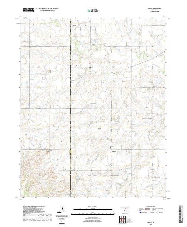
2022 Map of Omega
USGS Topo · Published 2022About this map
The border of Blaine County and Kingfisher County cuts through this rural Oklahoma landscape, where the small settlements of Omega and Altona serve as the primary anchors. This region is defined by a dense grid of section roads, including Broadway and Park Community Rd, which weave through a rolling terrain sculpted by the drainage of Kingfisher Creek, Otter Creek, and Little Otter Creek.
Find a feature on this map
33 named features on this map. Tap any name to fly to it.
Don’t see what you’re looking for? This feature index may not catch every label — zoom into the map to look around manually.
Map Details
Editions of this 2022 Omega Map
This is the sole edition of this map. No revisions or reprints were ever made.
Other maps of this area

1893 · Fort Reno
USGS Topo · 1:62,500

1893 · Loyal
USGS Topo · 1:62,500

1941 · Fort Reno
USGS Topo · 1:62,500

1942 · Fort Reno
USGS Topo · 1:62,500

1942 · Geary
USGS Topo · 1:62,500

1949 · Fort Reno
USGS Topo · 1:62,500

1955 · Clinton
USGS Topo · 1:250,000

1957 · Clinton
USGS Topo · 1:250,000
1972 · Loyal SE
USGS Topo · 1:24,000
1972 · Omega
USGS Topo · 1:24,000