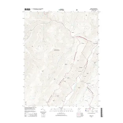
2014 Map of Onego
USGS Topo · Published 2014About this map
The North Fork South Branch Potomac River carves a deep path through the West Virginia highlands, defining the landscape around Onego and Seneca Rocks. This survey illustrates the intricate drainage network of the Monongahela National Forest, where tributaries like Seneca Cr and Brushy Run descend from the heights of Spruce Mtn. The map highlights the localized settlement patterns of Teterton and Macksville, which are hemmed in by prominent ridges such as the River Knobs and Fore Knobs. A notable geographic feature is the Germany Valley, a distinct karst basin east of the river, containing Judy Spring. The terrain is marked by numerous gaps and hollows, including Hinkle Gap and Mexico Hollow, which historically dictated the passage of early roads and small Appalachian communities.
Find a feature on this map
49 named features on this map. Tap any name to fly to it.
Don’t see what you’re looking for? This feature index may not catch every label — zoom into the map to look around manually.
Map Details
Editions of this 2014 Onego Map
This is the sole edition of this map. No revisions or reprints were ever made.
Other maps of this area

1889 · Beverly
USGS Topo · 1:125,000

1892 · Beverly
USGS Topo · 1:125,000

1892 · Franklin
USGS Topo · 1:125,000

1896 · Franklin
USGS Topo · 1:125,000

1920 · Onego
USGS Topo · 1:62,500

1921 · Onego
USGS Topo · 1:48,000

1922 · Onego
USGS Topo · 1:62,500

1922 · Horton
USGS Topo · 1:48,000

1922 · Spruce Knob
USGS Topo · 1:48,000

1922 · Circleville
USGS Topo · 1:62,500