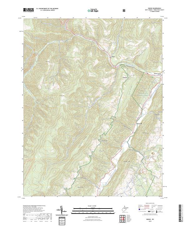
2023 Map of Onego
USGS Topo · Published 2023About this map
Seneca Creek and its many tributaries, such as Whites Run and Strader Run, carve through the high elevations of the Monongahela National Forest in this 2023 survey. The landscape is defined by the massive spine of Spruce Mtn and the distinct parallel ridges of the Fore Knobs and River Knobs. These geological formations enclose the deep corridor of the North Fork South Branch Potomac River, where settlements like Onego, Macksville, and the base of the iconic Seneca Rocks are situated.
Find a feature on this map
46 named features on this map. Tap any name to fly to it.
Don’t see what you’re looking for? This feature index may not catch every label — zoom into the map to look around manually.
Map Details
Editions of this 2023 Onego Map
This is the sole edition of this map. No revisions or reprints were ever made.
Other maps of this area

1889 · Beverly
USGS Topo · 1:125,000

1892 · Beverly
USGS Topo · 1:125,000

1892 · Franklin
USGS Topo · 1:125,000

1896 · Franklin
USGS Topo · 1:125,000

1920 · Onego
USGS Topo · 1:62,500

1921 · Onego
USGS Topo · 1:48,000

1922 · Onego
USGS Topo · 1:62,500

1922 · Horton
USGS Topo · 1:48,000

1922 · Spruce Knob
USGS Topo · 1:48,000

1922 · Circleville
USGS Topo · 1:62,500