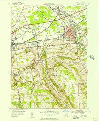
1955 Map of Oneida
USGS Topo · Published 1957About this map
The industrial and agricultural heart of Madison County is documented here as the mid-century transportation landscape shifts. The central corridor is dominated by the New York Central railroad and the State Thruway, which run parallel to the historic remnants of the Erie Canal (Abandoned) and the Oneida Canal. In the city of Oneida, civic life is anchored by the Armory and local institutions, while nearby Oneida Castle and the county seat at Wampsville—home to the Court House—illustrate the dense cluster of settlements along the primary transit lines.
Find a feature on this map
52 named features on this map. Tap any name to fly to it.
Don’t see what you’re looking for? This feature index may not catch every label — zoom into the map to look around manually.
Map Details
Editions of this 1955 Oneida Map
4 editions found
Other maps of this area

1895 · Chittenango
USGS Topo · 1:62,500

1895 · Oneida
USGS Topo · 1:62,500

1897 · Cazenovia
USGS Topo · 1:62,500

1898 · Oneida
USGS Topo · 1:62,500

1898 · Chittenango
USGS Topo · 1:62,500

1899 · Cazenovia
USGS Topo · 1:62,500

1902 · Chittenango
USGS Topo · 1:62,500

1902 · Morrisville
USGS Topo · 1:62,500

1902 · Oneida
USGS Topo · 1:62,500

1939 · Oneida
USGS Topo · 1:62,500