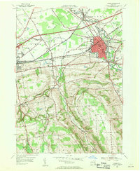
1955 Map of Oneida
USGS Topo · Published 1957About this map
Oneida and Wampsville serve as the primary hubs in this mid-century survey of the Oneida and Madison County border. The landscape is a corridor of transportation history, where the Old New York State Canal (Abandoned) and the Oneida Lake Canal intersect with the modern New York State Thruway and the New York Central railroad. This overlap of infrastructure reveals how the region evolved from a water-driven economy to a high-speed transit artery.
Find a feature on this map
47 named features on this map. Tap any name to fly to it.
Don’t see what you’re looking for? This feature index may not catch every label — zoom into the map to look around manually.
Map Details
Editions of this 1955 Oneida Map
4 editions found
Other maps of this area

1895 · Chittenango
USGS Topo · 1:62,500

1895 · Oneida
USGS Topo · 1:62,500

1897 · Cazenovia
USGS Topo · 1:62,500

1898 · Oneida
USGS Topo · 1:62,500

1898 · Chittenango
USGS Topo · 1:62,500

1899 · Cazenovia
USGS Topo · 1:62,500

1902 · Chittenango
USGS Topo · 1:62,500

1902 · Morrisville
USGS Topo · 1:62,500

1902 · Oneida
USGS Topo · 1:62,500

1939 · Oneida
USGS Topo · 1:62,500